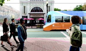
OC Streetcar
This is a visual simulation of the future alignment of the OC Streetcar. OC Streetcar is the first modern streetcar project to be built in Orange County and will provide improved transit access to important employment, restaurant, and retail centers in Santa Ana, Garden Grove, and surrounding areas. The Streetcar will also provide a convenient “last mile” connection between Metrolink trains and other transportation modes at the Santa Ana Regional Transit Center.
Sunday on Main Open Streets
In 2014, the City of Santa Ana hosted Orange County's first ever ciclovia, an open streets event where the streets were closed to motorized vehicles and open for people to walk and bicycle. The route connected Santa Ana's vibrant downtown to its historic South Main Corridor, with plenty of family-friendly activities, games, and information booths along the three mile route.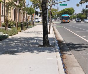
Complete Streets Improvements along Harbor Boulevard
After the Harbor Corridor Specific Plan was adopted in 2014, the City began implementing improvements (painting, striping, and spacing for a Class 4 Cycle Track) and applying streetscape requirements to new development (wide sidewalks with street trees and lighting) to make Harbor Boulevard a more complete street and accommodate vehicles, transit users, bicyclists, and pedestrians in a safe, efficient, and attractive manner.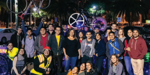
Programs and Activities to Promote Walking and Biking
To make bicycling and walking safer, more fun, and easy to do, the City teams with transit, health, and other local organizations to organize and promote activities such as open streets events, family-friendly bike rides, walk-to-school days, winter evening walk and ride events (pictured at top), food-focused bike rides, female-focused bike rides (pictured above), and walking tours.
Crossing the Street in the Lacy Neighborhood
A crossing guard helps a family safely cross Brown Street from Garfield Elementary School and its new Wellness Center (opened in 2020), which is housed in a historic Pacific Electric substation that once served the Red Car railways system.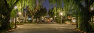
Local Streets in Wilshire Square
Shown here is Russell Avenue at the intersection of Van Ness Avenue in the Wilshire Square neighborhood. Both streets offer two travel lanes, on-street parking, sidewalks, and pedestrian-scaled lighting. Russell Avenue offers wide-canopied street trees while Van Ness Avenue is lined with tall palm trees.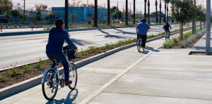
Cycle Track along Bristol Street
As part of the Bristol Street Specific Plan, the City constructed (in 2018) a six-foot-wide bike lane, a concrete curb with plantings separating the bike lane from general traffic lanes, and a greenway separating the bike lane from the sidewalk.